
Trace a Falls Township Street Directory by Address
A complete situs address, meaning the physical property address, is the right starting point for a Falls Township street search. It can identify a Falls Township parcel and show the current property record, but it does not prove who is physically present in a home. The County separates its map tools from the official owner route for that reason. Keep the street number, direction, street name, suffix, parcel number, and the date of each result together. That basic record trail is especially useful where a tax mailing address differs from the Falls Township situs address.
- Run the address through the Bucks Board of Assessment Public Access route to obtain the property result and parcel context.
- Use the Bucks Parcel & Floodplain Viewer to locate the same parcel, its boundaries, and nearby address points.
- For a title question, carry the parcel and current owner to the Recorder’s party index rather than treating a map result as title proof.
- Read the purchase document, legal description, and prior party, then repeat the party search to move back through recorded ownership.
- Use dated historical sources only for their stated period. The Falls Township city directory collections can add older place or address context without standing in for a current household list.
This Falls Township chain preserves the distinction between land records and resident evidence. It can show who is named in a property or recorded instrument, when a document was filed, and how the parcel is described. It cannot convert a property record into a complete street-by-street household roster.
Search Falls Township Streets in Assessment
The Falls Township property route at the Board of Assessment is the formal county address route when its Public Access portal is available. Its address search separates Number, Direction, Street, and Suffix, which matters when a street name is common or an address is entered in a different format. Owner and parcel searches have their own routes. Results are limited to 20 alphanumerically ordered entries per page, then open to Profile, Sales, Permits, and Map categories. Assessment data refreshes weekly on Monday late evening, so a very recent recorded transfer can appear first at the Recorder.
| Assessment field | Entry method | Result use |
|---|---|---|
| Number | Street number | Narrows the property address. |
| Direction | Dropdown selection | Separates directional street forms. |
| Street and Suffix | Street text and suffix dropdown | Builds the address search used for a Falls Township street. |
| Owner or Parcel ID | Name or parcel route, with wildcard support | Connects a known party or parcel to the property card. |
The Bucks assessment search help shows the separate field choices used for a precise address query.
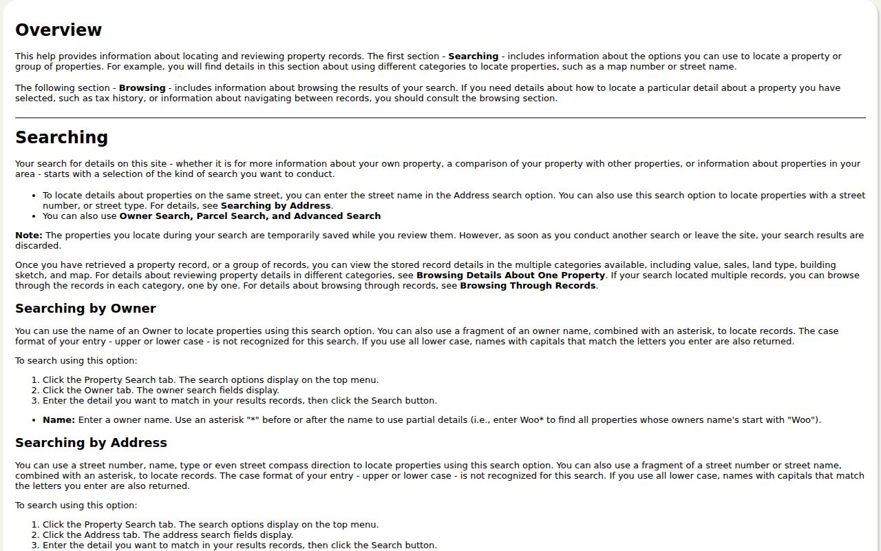
Those fields help prevent a loose street-name search from mixing unrelated addresses. When the assessment display and a recent deed disagree, the Board directs users to seek clarification because its public feed may lag a recording.
Map Falls Township Addresses to Parcels
The County Parcel & Floodplain Viewer is the spatial part of a by-address search. Its Search Map sources include Bucks County Parcels, municipal zoning, and Address Search. For Falls Township, a parcel popup can show the parcel number, address, municipality, deed area, land and building values, land-use code, and shape measurements. The Viewer also supports an exact parcel query and a Parcel Buffer. A point, line, or extent can be drawn, with a default 100-foot buffer for the parcel layer.
Owner-name search and owner popup data were removed from the public Viewer for privacy. That design is a boundary, not a gap to work around. Use the map to orient the Falls Township address and identify the parcel, then move to Assessment or the Tax Claim inquiry for their stated records. The map shows parcel geography and nearby boundaries, not occupants or an owner directory.
Decode Falls Township Street Deed Parties
The Bucks County Recorder of Deeds / Property Records path follows parties, not street names. For a Falls Township title question, begin with the current owner’s purchase instrument. In LANDEX, a seller or borrower is indexed as a Direct Party, while a buyer or lender is an Indirect Party. Read the legal description and prior party, then look for that prior party as an earlier buyer. Carry the parcel or legal-description detail through every step to separate people with similar names.
LANDEX offers General, Instrument Number, and Book/Page searches. The General tab requires Bucks County and a document category, and accepts party names and a date range. Asterisk and question-mark wildcards work in names, but the result ceiling is 250 name matches. Records after July 1, 2012 use instrument numbers instead of book and page citations. The Recorder’s public research area, phone, mail, and counter routes remain useful when an older index must be checked manually.
The Bucks County Property Records page identifies the Recorder access channel for a Falls Township title trail.
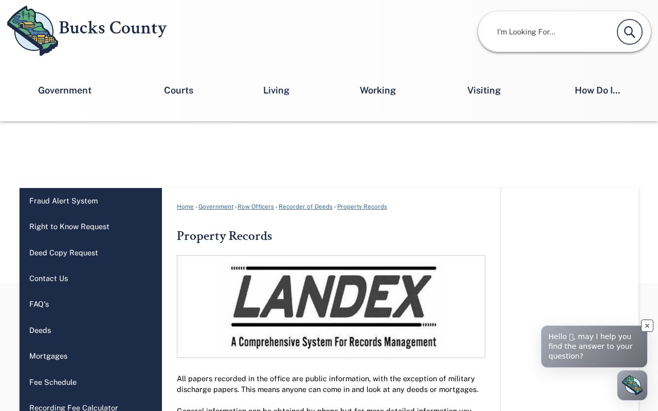
For Falls Township, the Recorder describes records from 1684 to the present, but an index search is still a party-and-document process rather than a direct street browse. Browser orders are paid and are not a certified-copy route; the counter, phone, and mail channels have their own copy process.
Note: A current assessment owner display can lag a recording, so a recent transaction calls for a Recorder check before relying on the property trail.
Falls Township Street Record Coverage
Falls Township address-keyed sources have different coverage and limits. A parcel number links the spatial map, Assessment record, and deed trail. A municipal permit may document a dated application or inspection. A Tax Claim result concerns delinquent real-estate taxes. None of these sources is proof of every person who may live at an address, and each should be read for the fact it actually records.
| Address record | Custodian | What it can show | Access boundary |
|---|---|---|---|
| Property card and mapping | Bucks Board of Assessment | Parcel, value, sales, map, and current property context | Public Access or counter; weekly feed. |
| Parcel map | Bucks Parcel & Floodplain Viewer | Address, parcel, boundary, value, and land-use context | Free map; owner fields are hidden. |
| Recorded instruments | Bucks County Recorder of Deeds | Title parties, recorded date, and legal description | LANDEX, counter, phone, or mail. |
| Delinquent-tax inquiry | Bucks Tax Claim Bureau | Tax Claim search fields and related delinquent-tax record | Not occupancy evidence or a full assessment substitute. |
| Permit or zoning file | Falls Township Code Enforcement | Defined application, work, inspection, or zoning material | Portal or defined public-record request, subject to retention. |
For a Falls Township result, the best order is address to parcel, parcel to the record custodian, and owner or document party to the Recorder when title needs confirmation. A mailing address is tax correspondence and may differ from the physical situs address, so it should not be used as proof of occupancy.
Define Falls Township Street Record Terms
A few record terms keep a Falls Township address search from joining unlike information. The County uses a parcel number to bridge the map and property systems, while a deed or plan supplies the land description that supports a title trail. Historical directories may organize the same information differently. Record the term used by the source, the address form, and the date before comparing two results.
- Parcel
- The County identifier assigned through tax mapping. It links the mapped property to Assessment and recorded-instrument research.
- Situs address
- The physical property location. It can differ from an owner’s mailing address, which is tax correspondence.
- Plat or plan
- A recorded drawing or plan reference used with the legal description to identify the land conveyed.
- Criss-cross directory
- A directory arranged by address rather than by name. Its value depends on the date and coverage of the historical volume.
These distinctions prevent a street, parcel, mailing address, and title description from being treated as interchangeable. They also make a later Recorder or Assessment check easier to reproduce.
Check Postal Labels on Falls Township Streets
Postal geography is not the same as Falls Township jurisdiction. County address points for the Township carry four postal community labels: Fairless Hills, Langhorne, Levittown, and Morrisville. A street address with one of those labels can still be in Falls Township, while the postal community itself can cross municipal lines. Use the County municipality field to determine the local jurisdiction, and use USPS to verify delivery formatting for one address.
The distinction in Falls Township matters because a historic or recorded document may use a place label different from today’s Township wording. A modern postal ZIP should not replace the parcel, legal description, or municipal field when identifying property. Search-format differences, such as an abbreviated highway name versus a fully spelled name, are also format differences, not proof that a street changed names.
Note: A postal community label can help locate an address, but the County municipal field is the stronger check for Falls Township jurisdiction.
Use Falls Township Address Permit Clues
Falls Township municipal permit material can add a dated layer to a property trail. The Falls Township BS&A route begins with street number and street name without the suffix. For a defined request, the most useful details are the permit or application number, application date, work description, plans, inspection or final outcome, applicant or agent, and any related zoning decision. A permit can explain construction or alteration activity at an address, but it does not establish a complete household history.
The Falls Township record-search and permit entry route is the municipal starting point for that address-based supplement.
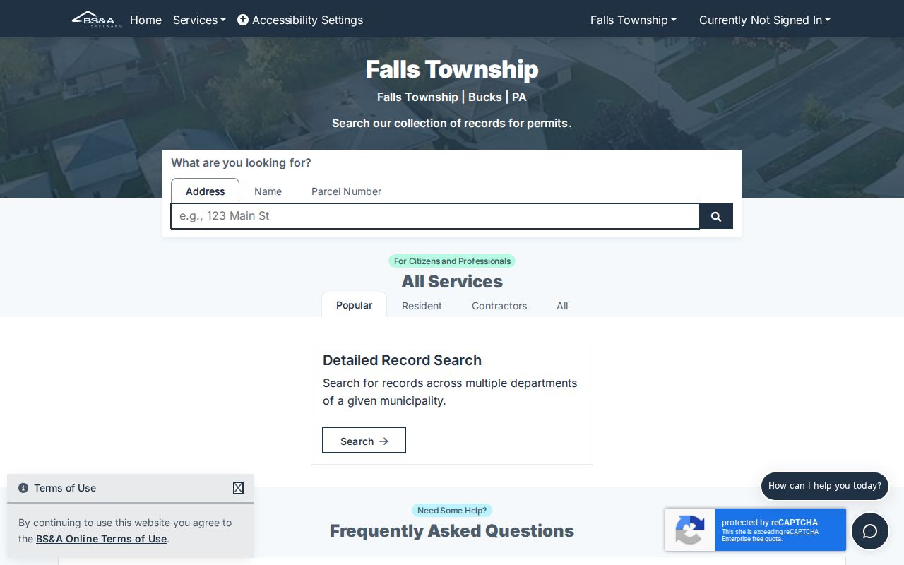
No verified historic Falls Township permit cutoff was located. A request should therefore describe the address and the records sought, rather than assume a particular year range is complete.
Keep Falls Township Street Voter Data Limited
Pennsylvania’s voter status service is an exact personal verification route, not a Falls Township street-browsing tool. Its name route requires county, first name, last name, and date of birth, with house number used only to resolve multiple exact candidates. The identification route requires a Pennsylvania driver-license or PennDOT ID number and date of birth. A successful individual result can show status, party, polling place, districts, and residential or mailing labels, but it is not an address browser.
For Falls Township, state election rules permit specified public information while limiting the use and distribution of voter lists. Street and walking lists carry restricted-use and no-online-publication requirements. Pennsylvania’s Address Confidentiality Program can also produce a substitute address, so a mismatch can reflect protection rather than an error. Use election records only through the lawful channel and for their narrow documented purpose.
Note: An address nonmatch in a voter source is not proof that someone is absent from Falls Township or from a particular property.
Read Historic Falls Township Street Labels
Falls Township records use more than one place label over time. Fallsington is the older crossroads and records anchor. Fairless Hills and Levittown became important postwar community names after the Fairless Works development, while Route 13 follows the earlier King’s Highway corridor. The Delaware Canal and rail routes also affect how local documents describe place. A historical index may therefore be easier to search with Falls Township, Fallsington, Fairless Hills, Levittown, or a nearby place label from the record’s era.
Do not assume that a modern street or ZIP wording appears in an older deed, map, directory, or census record. The County did not verify a Falls street-renumbering project, so no renumbering year should be inferred. A legal description, plan reference, and parcel context are stronger anchors when an old address label is uncertain.
Source coverage also changes by era. Historic Fallsington holds local deeds from 1794 to 1927, maps from 1849 to 1974, and Falls telephone papers from 1908 to 1929. Verified County directory editions include 1860, 1871, 1894, 1902, and 1914. These sources can provide an address, family, place, or post-office clue for their own dates, but none creates continuous proof of occupancy. Pair an older directory or map entry with its date, place label, and the related deed or census evidence.
What a Falls Township Street Directory Leaves Private
A Falls Township street-by-address record trail does not reveal every household member, private utility or delivery information, closed motor-vehicle address data, protected residents, or an unrestricted voter list. The public parcel viewer intentionally withholds owner information. Assessment and the Recorder can provide their own documented records, but even an owner name or mailing address is not proof of present occupancy. Pennsylvania confidentiality protections, including the Address Confidentiality Program, can lawfully change what an otherwise familiar address search shows.
A nonmatch is not proof that a person is absent from a street or that a record never existed. It may reflect the source’s coverage, a changed mailing label, a recent recording that has not reached the weekly assessment feed, or a lawful confidentiality limit. Confirm the particular fact with the office that keeps the relevant record.
Lawful use. Falls Township address records are for personal, lawful research. Do not use a street search to stalk, harass, intimidate, or harm anyone, and verify important information with the custodian that holds the record.